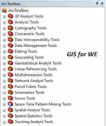
Moving Window Kriging Tool
أداة تحريك نافذة الكرينج
ArcMap ArcGIS
How to use Moving Window Kriging Tool in ArcToolbox ArcMap ArcGIS??
كيفية استخدام أداة تحريك نافذة الكرينج ؟؟
Path
to access the toolمسار الوصول الى الأداة
:
Moving
Window Kriging Tool, Interpolation Toolset, Geostatistical
Analyst Tools Toolbox
Moving Window Kriging
Recalculates the Range,
Nugget, and Partial Sill semivariogram parameters based on a smaller
neighborhood, moving through all location points.
يعيد حساب معلمات مخطط النطاق والكتلة والعتبة
الجزئية بناءً على حي أصغر ، والتنقل عبر جميع نقاط الموقع.
1.
Input geostatistical model source إدخال
مصدر النموذج الإحصائي الجغرافي
The geostatistical model
source to be analyzed.
مصدر النموذج الجغرافي الإحصائي المراد تحليله.
2.
Input dataset(s) مجموعة او مجموعات
البيانات المدخلة
The name of the input
datasets and field names used in the creation of the output layer.
When checked, the Always
reset input datasets when the geostatistical model source changes parameter
ensures that when a different geostatistical model source is specified, its
associated datasets are automatically inserted into the tool. If unchecked and
the geostatistical model source is changed, the displayed input datasets remain
unchanged. This can lead to problems if the model is incompatible with the
dataset; for example, a model was created to predict temperature, and a new
dataset with rainfall data is specified.
اسم مجموعات بيانات الإدخال وأسماء الحقول
المستخدمة في إنشاء طبقة الإخراج.
عند تحديد هذا الخيار ، تضمن معلمة إعادة تعيين
مجموعات بيانات الإدخال دائمًا عند تغيير مصدر النموذج الجغرافي الإحصائي أنه عند
تحديد مصدر نموذج إحصائي جيوإحصائي مختلف ، يتم إدراج مجموعات البيانات المرتبطة
به تلقائيًا في الأداة. إذا لم يتم تحديده وتم تغيير مصدر النموذج الجغرافي الإحصائي
، فإن مجموعات بيانات الإدخال المعروضة تظل دون تغيير. يمكن أن يؤدي هذا إلى مشاكل
إذا كان النموذج غير متوافق مع مجموعة البيانات ؛ على سبيل المثال ، تم إنشاء
نموذج للتنبؤ بدرجة الحرارة ، وتم تحديد مجموعة بيانات جديدة ببيانات هطول
الأمطار.
3.
Input point observation locations مواقع
مراقبة نقطة الإدخال
Point locations where
predictions will be performed.
مواقع النقطة حيث سيتم تنفيذ التنبؤات.
4.
Maximum neighbors to include الحد الأقصى
من الجيران لتضمينها
Number of neighbors to
use in the moving window.
عدد الجيران لاستخدامهم في النافذة المتحركة.
5.
Output feature class فئة ميزة
الإخراج
Feature class storing
the results.
فئة الميزة تخزين النتائج.
6.
Output cell size (optional) حجم
خلية الإخراج (اختياري)
The cell size at which
the output raster will be created.
This value can be
explicitly set under Raster Analysis from the Environment Settings.
If not set, it is the
shorter of the width or the height of the extent of the input point features,
in the input spatial reference, divided by 250.
حجم الخلية التي سيتم إنشاء البيانات النقطية
للإخراج بها.
يمكن تعيين هذه القيمة بشكل صريح ضمن تحليل
البيانات النقطية من إعدادات البيئة.
إذا لم يتم تعيينه ، فهو أقصر عرض أو ارتفاع مدى
معالم نقطة الإدخال ، في الإسناد المكاني للإدخال ، مقسومًا على 250.
7.
Output surface raster (optional) النقطية
السطحية الإخراج (اختياري)
The prediction values in
the output feature class are interpolated onto a raster using the Local
polynomial interpolation method.
يتم استيفاء قيم التنبؤ في فئة ميزة الإخراج على
خطوط المسح باستخدام طريقة الاستيفاء المحلي متعدد الحدود.
اليك صفحه ومجموعة على الفيس بوك لتعلم أكثر بما يخص نظم المعلومات الجغرافية (GIS) و برنامج ArcGIS Pro من خلال هذه الروابط:


تعليقات
إرسال تعليق