Calculate Z-value and Create Geostatistical Layer Tools
Calculate Z-value
أداة احسب قيمة
ArcMap ArcGIS
How to use Calculate Z-value Tool in Arc Toolbox ArcMap ArcGIS??
كيفية استخدام أداة احسب قيمة الإرتفاع ؟؟
Path
to access the toolمسار الوصول الى الأداة
:
Calculate
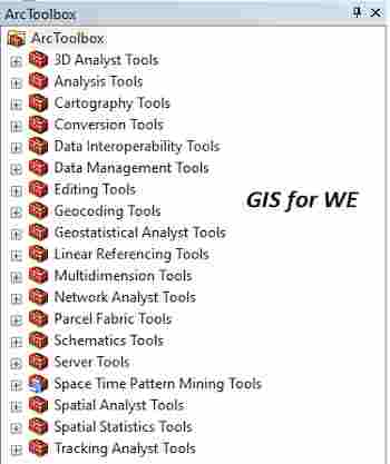
Z-value Tool, Working with Geostatistical Layers Toolset, Geostatistical
Analyst Tools Toolbox
Calculate Z-value
Uses the interpolation
model in a geostatistical layer to predict a value at a single location.
يستخدم نموذج الاستيفاء في طبقة إحصائية جغرافية
للتنبؤ بقيمة في مكان واحد.
1.
Input geostatistical layer إدخال
طبقة إحصائية جغرافية
The geostatistical layer
to be analyzed.
الطبقة الإحصائية المراد تحليلها.
2.
Input point أدخل النقطة
The x,y coordinate of
the point for which the Z-value will be calculated.
إحداثي x و y
للنقطة التي سيتم حساب قيمة Z لها.
Create Geostatistical Layer
أداة إنشاء طبقة إحصائية جغرافية
ArcMap ArcGIS
How to use Create Geostatistical Layer Tool in Arc Toolbox ArcMap ArcGIS??
كيفية استخدام أداة احسب قيمة الارتفاع ؟؟
Path
to access the toolمسار الوصول الى الأداة
:
Create
Geostatistical Layer Tool, Working with Geostatistical
Layers Toolset, Geostatistical Analyst Tools Toolbox
Create Geostatistical Layer
Creates a new
geostatistical layer. An existing geostatistical layer or geostatistical model
is required to populate the initial values for the new layer. The input to this
tool can be created using the Geostatistical Wizard.
يُنشئ طبقة إحصائية جغرافية جديدة. مطلوب طبقة
جيوإحصائية موجودة أو نموذج جيوإحصائي لتعبئة القيم الأولية للطبقة الجديدة. يمكن
إنشاء المدخلات إلى هذه الأداة باستخدام معالج Geostatistical.
1.
Input geostatistical model source إدخال
مصدر النموذج الإحصائي الجغرافي
The geostatistical model
source to be analyzed.
مصدر النموذج الجغرافي الإحصائي المراد تحليله.
2.
Input dataset(s) إدخال مجموعة
(مجموعات) البيانات
The name of the input
datasets and field names used in the creation of the output layer.
When checked, the Always
reset input datasets when the geostatistical model source changes parameter
ensures that when a different geostatistical model source is specified, its
associated datasets are automatically inserted into the tool.
If unchecked and the
geostatistical model source is changed, the displayed input datasets remain
unchanged. This can lead to problems if the model is incompatible with the
dataset; for example, a model was created to predict temperature, and a new
dataset with rainfall data is specified.
اسم مجموعات بيانات الإدخال وأسماء الحقول
المستخدمة في إنشاء طبقة الإخراج.
عند تحديد هذا الخيار ، تضمن معلمة إعادة تعيين
مجموعات بيانات الإدخال دائمًا عند تغيير مصدر النموذج الجغرافي الإحصائي أنه عند
تحديد مصدر نموذج إحصائي جيو إحصائي مختلف ، يتم إدراج مجموعات البيانات المرتبطة
به تلقائيًا في الأداة.
إذا لم يتم تحديده وتم تغيير مصدر النموذج
الجغرافي الإحصائي ، فإن مجموعات بيانات الإدخال المعروضة تظل دون تغيير. يمكن أن
يؤدي هذا إلى مشاكل إذا كان النموذج غير متوافق مع مجموعة البيانات ؛ على سبيل
المثال ، تم إنشاء نموذج للتنبؤ بدرجة الحرارة ، وتم تحديد مجموعة بيانات جديدة
ببيانات هطول الأمطار.
3.
Output geostatistical layer الطبقة
الإحصائية الناتجة
The geostatistical layer
produced by the tool.
الطبقة الإحصائية الجيوإحصائية التي تنتجها الأداة.
اليك صفحه ومجموعة على الفيس بوك لتعلم أكثر بما يخص نظم المعلومات الجغرافية (GIS) و برنامج ArcGIS Pro من خلال هذه الروابط:


تعليقات
إرسال تعليق