Calculate Transformation Errors
أداة حساب أخطاء التحويل
ArcMap ArcGIS
How to Calculate Transformation Errors Tool in Arc Toolbox ArcMap ArcGIS??
كيفية استخدام أداة حساب أخطاء التحويل ؟؟
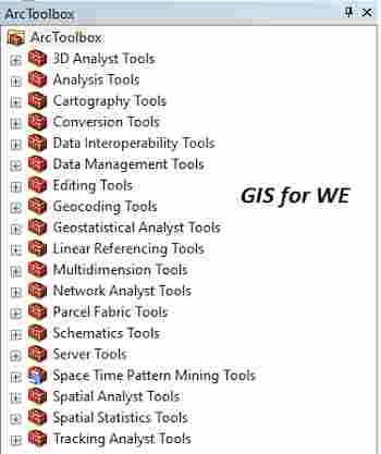
Path to access the toolمسار الوصول الى الأداة
:
Calculate Transformation Errors Tool, Conflation Toolset, Editing Tools Toolbox
Calculate Transformation Errors
Calculates residue
errors and root mean square error (RMSE) based on the coordinates of the input
links between known control points to be used for spatial data transformation.
لحساب أخطاء المخلفات وخطأ جذر متوسط التربيع (RMSE)
بناءً على إحداثيات روابط الإدخال بين نقاط التحكم المعروفة لاستخدامها في تحويل
البيانات المكانية.
1.
Input Link Features ميزات روابط
الإدخال
Input link features that
link known control points for spatial transformation.
ميزات روابط الإدخال التي تربط نقاط التحكم
المعروفة للتحويل المكاني.
2.
Output Link Table جدول الرابط
المخرج
The output table
containing input links feature IDs and their residual errors. The residual
errors for input links are written to the specified output table that contains
the following fields:
يحتوي جدول الإخراج الذي يحتوي على روابط الإدخال
على معرفات ميزة وأخطاءها المتبقية. تتم كتابة الأخطاء المتبقية لارتباطات الإدخال
في جدول الإخراج المحدد الذي يحتوي على الحقول التالية:
• Orig_FID: معرف ميزة ارتباط الإدخال
• X_Source: إحداثي x
للمصدر أو من موقع نهاية الارتباط
• Y_Source: إحداثي y
للمصدر أو من موقع نهاية الارتباط
• X_Destination: إحداثي x
للوجهة أو موقع نهاية الارتباط
• Y_Destination: إحداثي y
للوجهة أو موقع نهاية الارتباط
• الخطأ المتبقي: الخطأ
المتبقي للموقع المحول
3.
Method (optional) الطريقة (اختياري)
Transformation method to
use to convert input feature coordinates.
·
AFFINE—Affine transformation requires a minimum of three
transformation links. This is the default.
·
PROJECTIVE—Projective transformation requires a minimum of four
transformation links.
·
SIMILARITY—Similarity transformation requires a minimum of two
transformation links.
طريقة التحويل لاستخدامها في تحويل إحداثيات ميزة
الإدخال.
• AFFINE -
يتطلب التحويل Affine ما لا يقل عن ثلاثة
روابط تحويل. هذا هو الافتراضي.
• استباقي - يتطلب التحول
الإسقاطي ما لا يقل عن أربعة روابط تحويل.
• التشابه - يتطلب تحويل التشابه
ما لا يقل عن رابطتي تحويل.
اليك صفحه ومجموعة على الفيس بوك لتعلم أكثر بما يخص نظم المعلومات الجغرافية (GIS) و برنامج ArcGIS Pro من خلال هذه الروابط:


تعليقات
إرسال تعليق