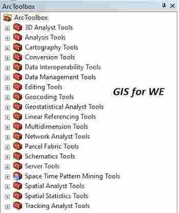
Edgematch Features and Generate Edgematch Links Tools
Edgematch Features
أداة ميزات مطابقة
الحافة
ArcMap ArcGIS
How to Edgematch Features Tool in Arc Toolbox ArcMap ArcGIS??
كيفية استخدام أداة ميزات مطابقة الحافة ؟؟
Path to access the toolمسار الوصول الى الأداة
:
Edgematch Features Tool,
Conflation Toolset, Editing Tools Toolbox
Edgematch Features
Modifies input line
features by spatially adjusting their shapes, guided by the specified edgematch
links, so they become connected with the lines in the adjacent dataset.
يعدل ميزات خط الإدخال عن طريق ضبط أشكالها
مكانيًا ، مسترشدًا بروابط edgematch
المحددة ، بحيث تصبح متصلة بالخطوط في مجموعة البيانات المجاورة.
1.
Input Features ميزات الإدخال
Input line features to
be adjusted.
يتم تعديل ميزات خط الإدخال.
2.
Input Link Features أدخل ميزات
الروابط
Input line features
representing edgematch links.
ميزات خط الإدخال التي تمثل روابط مطابقة الحافة.
3.
Method (optional) الطريقة (اختياري)
Edgematch method to be
used to adjust either input features only or both input features and adjacent
features to new connecting locations.
·
MOVE_ENDPOINT—Moves the endpoint of a line to the new connecting
location. This is the default.
·
ADD_SEGMENT—Adds a straight segment at the end of a line so it
ends at the new connecting location.
·
ADJUST_VERTICES—Adjusts the endpoint of a line to the new
connecting location. The remaining vertices are also adjusted so its positional
changes are gradually reduced toward the opposite end of the line.
يتم استخدام أسلوب Edgematch لضبط ميزات الإدخال فقط أو ميزات الإدخال والميزات المجاورة
لمواقع الاتصال الجديدة.
• نقل نقطة النهاية -
ينقل نقطة نهاية الخط إلى موقع الاتصال الجديد. هذا هو الافتراضي.
• إضافة مقطع - يضيف
مقطعًا مستقيمًا في نهاية السطر بحيث ينتهي عند موقع الاتصال الجديد.
• ADJUST VERTICES - يضبط نقطة نهاية الخط إلى موقع الاتصال الجديد. يتم أيضًا تعديل
الرؤوس المتبقية بحيث يتم تقليل التغييرات الموضعية تدريجياً باتجاه الطرف المقابل
من الخط.
4.
Adjacent Features (optional) الميزات
المجاورة (اختياري)
Line features that are
adjacent to input features. If specified, both the input and adjacent features
are adjusted to meet at new connecting locations, either the midpoints of the
edgematch links or locations nearest to the midpoints of the links on the
border features (if specified).
المعالم الخطية المجاورة لميزات الإدخال. إذا تم
تحديد ذلك ، يتم ضبط كل من المدخلات والمعالم المجاورة لتلتقي في مواقع الاتصال
الجديدة ، إما نقاط المنتصف لروابط edgematch أو
المواقع الأقرب لنقاط المنتصف للروابط الموجودة على معالم الحدود (إذا تم
تحديدها).
5.
Border Features (optional) ميزات
الحدود (اختياري)
Line or polygon features
representing borders between the input and adjacent features. When you specify
border features, both input and adjacent features are adjusted to meet at new
connecting locations nearest to the midpoints of the links on the border
features.
معالم خطية أو مضلعة تمثل الحدود بين المدخلات
والمعالم المجاورة. عند تحديد ميزات الحدود ، يتم ضبط كل من المدخلات والمعالم
المجاورة لتلتقي في مواقع الاتصال الجديدة الأقرب لنقاط المنتصف للروابط الموجودة
على معالم الحدود.
Generate Edgematch Links
أداة إنشاء روابط
مطابقة الحافة
ArcMap ArcGIS
How to Generate Edgematch Links Tool in Arc Toolbox ArcMap ArcGIS??
كيفية استخدام أداة إنشاء روابط مطابقة الحافة ؟؟
Path to access the toolمسار الوصول الى الأداة
:
Generate Edgematch Links Tool, Conflation Toolset, Editing Tools Toolbox
Generate Edgematch Links
Finds matching but
disconnected line features along the edges of the source data's area and its
adjacent data's area, and generates edgematch links from the source lines to
the matched adjacent lines.
يبحث عن المعالم الخطية المتطابقة ولكن غير
المتصلة على طول حواف منطقة البيانات المصدر ومنطقة البيانات المجاورة لها ، وينشئ
ارتباطات مطابقة الحافة من خطوط المصدر إلى الخطوط المجاورة المتطابقة.
1.
Source Features مصدر الميزات
Line features as
edgematching source features. All edgematch links start at source features.
ميزات الخط مثل ميزات مصدر مطابقة الحافة. تبدأ
جميع روابط مطابقة الحافة من ميزات المصدر.
2.
Adjacent Features الميزات المجاورة
Line features adjacent
to source features. All edgematch links end at matched adjacent features.
معالم الخط المجاورة لمعالم المصدر. تنتهي جميع
روابط مطابقة الحافة عند المعالم المتجاورة المتطابقة.
3.
Output Feature Class فئة ميزة
الإخراج
Output feature class
containing lines representing edgematch links.
تحتوي فئة معلم الإخراج على خطوط تمثل روابط
مطابقة الحافة.
4.
Search Distance مسافة البحث
The distance used to
search for match candidates. A distance must be specified and it must be
greater than zero. You can choose a preferred unit; the default is the feature
unit.
المسافة المستخدمة للبحث عن المرشحين للمباراة.
يجب تحديد مسافة ويجب أن تكون أكبر من الصفر. يمكنك اختيار الوحدة المفضلة ؛
الافتراضي هو وحدة الميزة.
5.
Match Fields (optional) تطابق
الحقول (اختياري)
Fields from source and
target features, where target fields are from the adjacent features. If
specified, each pair of fields are checked for match candidates to help
determine the right match.
الحقول من المعالم المصدر والهدف ، حيث تكون
الحقول الهدف من المعالم المجاورة. من المحدد ، يتم فحص كل زوج من الحقول بحثًا عن
المرشحين للمطابقة للمساعدة في تحديد التطابق الصحيح.
اليك صفحه ومجموعة على الفيس بوك لتعلم أكثر بما يخص نظم المعلومات الجغرافية (GIS) و برنامج ArcGIS Pro من خلال هذه الروابط:


تعليقات
إرسال تعليق