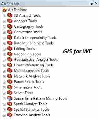
Majority Filter and Raster Calculator Tools
Majority Filter
أداة فلتر
الأغلبية
ArcMap ArcGIS
How to Majority Filter Tool
in Arc Toolbox ArcMap ArcGIS??
كيفية استخدام أداة فلتر الأغلبية
؟؟
Path
to access the toolمسار الوصول الى الأداة
:
Majority
Filter Tool, Generalization Toolset, Spatial Analyst Tools Toolbox
Majority Filter
Replaces cells in a
raster based on the majority of their contiguous neighboring cells.
يستبدل الخلايا في البيانات النقطية بناءً على
غالبية الخلايا المجاورة لها.
1.
Input raster أدخل النقطية
The input raster to be
filtered based on the majority of contiguous neighboring cells.
It must be of integer
type.
البيانات النقطية المدخلة لتتم تصفيتها بناءً على
غالبية الخلايا المجاورة المتجاورة.
يجب أن يكون من نوع عدد صحيح.
2.
Output raster النقطية المخرجة
The output filtered
raster.
The output is always of
integer type.
الناتج النقطي المصفاة.
يكون الإخراج دائمًا من نوع عدد صحيح.
3.
Number of neighbors to use (optional) عدد الجيران المراد استخدامها (اختياري)
Determines the number of
neighboring cells to use in the kernel of the filter.
·
FOUR— The kernel of the filter will be the four direct
(orthogonal) neighbors to the present cell. This is the default.
·
EIGHT— The kernel of the filter will be the eight nearest
neighbors (a three-by-three window) to the present cell.
يحدد عدد الخلايا المجاورة المراد استخدامها في
نواة المرشح.
• أربعة - ستكون نواة
المرشح هي الجوار المباشر (المتعامد) للخلية الحالية. هذا هو الافتراضي.
• ثمانية- نواة المرشح
ستكون أقرب ثمانية جيران (نافذة ثلاثة في ثلاثة) للخلية الحالية.
4.
Replacement threshold (optional) عتبة
الاستبدال (اختياري)
Specifies the number of
contiguous (spatially connected) cells that must be of the same value before a
replacement will occur.
·
MAJORITY— A majority of cells must have the same value and be
contiguous. Three out of four or five out of eight connected cells must have
the same value.
·
HALF— Half of the cells must have the same value and be
contiguous. Two out of four or four out of eight connected cells must have the
same value. This option will have a more smoothing effect than the other.
يحدد عدد الخلايا المتجاورة (المتصلة مكانيًا)
التي يجب أن تكون بنفس القيمة قبل حدوث الاستبدال.
• الأغلبية - يجب أن
تحتوي غالبية الخلايا على نفس القيمة وأن تكون متجاورة. يجب أن يكون لثلاث من أصل
أربعة أو خمسة من أصل ثماني خلايا متصلة نفس القيمة.
• نصف - يجب أن يكون لنصف
الخلايا نفس القيمة وأن تكون متجاورة. يجب أن تحتوي خليتان من أصل أربعة أو أربعة
من أصل ثماني خلايا متصلة على نفس القيمة. سيكون لهذا الخيار تأثير أكثر سلاسة من
الآخر.
Raster Calculator
أداة حساب
البيانات النقطية
ArcMap ArcGIS
How to Raster Calculator Tool in Arc Toolbox ArcMap ArcGIS??
كيفية استخدام أداة حساب البيانات النقطية
؟؟
Path
to access the toolمسار الوصول الى الأداة
:
Raster
Calculator Tool, Map Algebra Toolset, Spatial
Analyst Tools Toolbox
Raster Calculator
Builds and executes a
single Map Algebra expression using Python syntax in a calculator-like
interface.
يبني وينفذ تعبير Map Algebra واحدًا باستخدام بناء جملة Python في
واجهة تشبه الآلة الحاسبة.
1.
Map Algebra expression تعيين تعبير
الجبر
The Map Algebra
expression you want to run.
The expression is
composed by specifying the inputs, values, operators, and tools to use. You can
type in the expression directly or use the buttons and controls to help you
create it.
·
The Layers and variables list identifies the datasets available to
use in the Map Algebra expression.
·
The buttons are used to enter numerical values and operators into
the expression. The ( and ) buttons can be used to apply parentheses to the
expression.
·
A list of commonly used tools is provided for you.
تعبير Map Algebra الذي
تريد تشغيله.
يتكون التعبير من خلال تحديد المدخلات والقيم
والعوامل والأدوات المراد استخدامها. يمكنك كتابة التعبير مباشرة أو استخدام
الأزرار وعناصر التحكم لمساعدتك في إنشائه.
• تحدد قائمة الطبقات
والمتغيرات مجموعات البيانات المتاحة للاستخدام في تعبير Map Algebra.
• تستخدم الأزرار لإدخال
القيم العددية وعوامل التشغيل في التعبير. يمكن استخدام الزرين (و) لتطبيق الأقواس
على التعبير.
• يتم توفير قائمة
بالأدوات شائعة الاستخدام لك.
2.
Output raster النقطية الإخراج
The output raster
resulting from the Map Algebra expression.
النقطية الناتجة من تعبير خريطة الجبر.
اليك صفحه ومجموعة على الفيس بوك لتعلم أكثر بما يخص نظم المعلومات الجغرافية (GIS) و برنامج ArcGIS Pro من خلال هذه الروابط:


تعليقات
إرسال تعليق